"Running a climate model simulation is one thing – understanding what it does and why, is quite another"
20 November 2023
Born in Hamburg but settled down in Bonn after living and studying in several countries, ECMWF’s Matthias Aengenheyster says work and his passion for taking pictures often converge.
“I love biking, hiking and photography – locally or while travelling around. This also relates to science”, he claims. “One part of my work is visualising data to make sense of them. Sometimes this can almost stretch into art, tweaking the visualisation to be both nice to look at and to show the physical features that I am interested in”, the postdoc adds.
Aengenheyster started to work at ECMWF for EERIE after his PhD at UK’s University of Oxford. That was hardly his first time living abroad: “I’ve always liked moving around and meeting people from all over the place – spending a semester in Canada during high school, studying at hyper-international Jacobs University, doing degrees in the Netherlands and the UK, and shorter research stays in a few more countries”.
He says he’s happy to have “settled down a bit in Bonn”, but he’s quick to add – “one great thing about doing science, and in particular at ECMWF and international projects such as EERIE, is interacting with a lot of people – scientifically, personally and culturally. So I’m sitting in my office in Bonn having sweets that a colleague brought from Hungary, while asking someone in Spain about some problem I have with the climate model.”
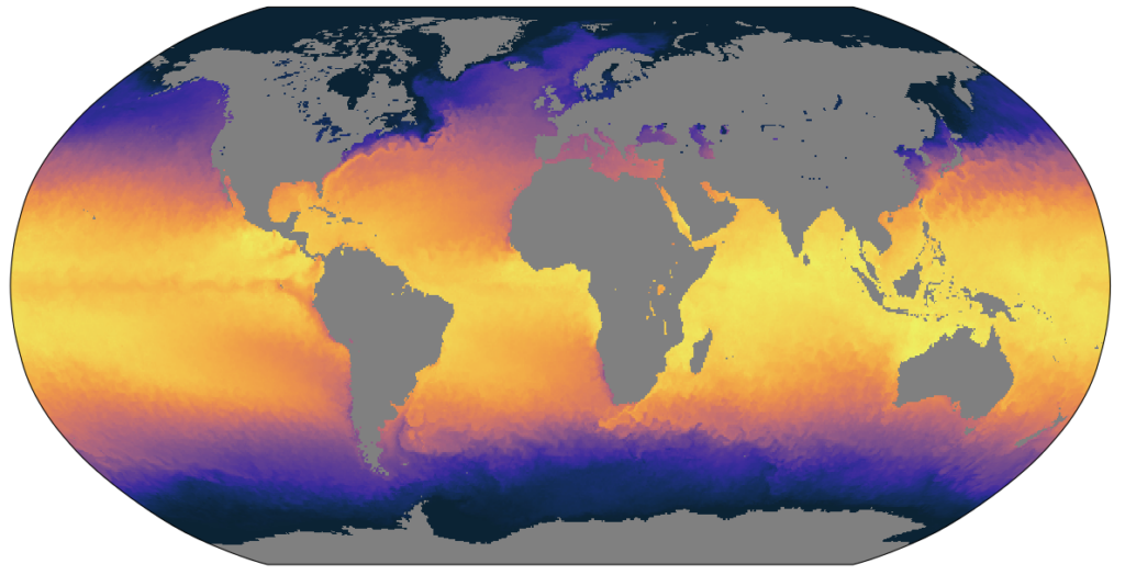
One day of observed sea-surface temperature from the OSTIA dataset at 1/20th degree spatial resolution (around 5 km).
“At the moment my focus is on addressing the various scientific and technical questions required to conduct the long model simulations”, Aengenheyster explains. “This involves choosing the sea surface temperature dataset and other physical input parameters, testing how the model behaves and how fast it runs. I am also involved in a lot of coordination in the project. Several institutions use the ECMWF model Integrated Forecasting System (IFS) as the atmospheric component of their coupled models, and everyone wants to be closely aligned.”
The ECMWF scientist maintains there’s a visible connection between his previous PhD work and his current job for the EERIE project. It lies “on the link provided by air-sea heat fluxes between oceanic and atmospheric dynamics”. He further adds: “Since starting to work on climate physics for my undergraduate thesis, I have worked on a range of scales in space, time and model complexity, from large-eddy simulations to simple climate emulators.”
In the case of EERIE, it’s “intimately concerned with how air-sea interactions impact weather and climate on timescale from subseasonal to multidecadal, spanning a broad range of processes and phenomena. This is scientifically very interesting (which small-scale features in the ocean have large-scale impacts in the atmosphere?) and also important for climate change (what do we need in ocean models and forecasting systems to describe the near-term weather and long-term climate trajectories?)”.
Aengenheyster points out “central to EERIE are the eddy-resolving coupled model integrations over many decades, with the goal of finding out the impact of mesoscale structures that can be resolved in high-resolution ocean models”.
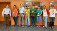
Aengenheyster during the EERIE Hackathon 2023 in Bremerhaven (Germany).
“One way to investigate this”, he says, “is to compare the results of high-resolution simulations with lower-resolution ones. However, the resolution of the ocean model affects many aspects of the ‘ocean state’, and so it is difficult to deduce how much of any difference is directly due to the presence of eddies”.
A way forward for this “is to conduct idealised experiments”. That’s why the ECMWF contribution to EERIE are the so-called AMIP simulations – “We run the atmospheric model without an ocean but directly provide the model with information about the sea surface, most importantly sea surface temperature, which we take from observational datasets. We can also remove mesoscale features from the observed sea surface temperature dataset, and thus compare between model atmospheres that have seen and have not seen mesoscale sea surface temperature variability, while the large scale features are the same”. The goal for this is answering a key question – “What is the impact on the atmosphere of the presence or absence of eddies, while the implied large-scale ocean state stays the same?”
This is not the only question to be answered, the scientist admits – “Running a climate model simulation is one thing, understanding what it does and why is quite another”.
“However this is the crucial bit”, he highlights – “Both to generate scientific insight and knowledge and to make those models and simulations useful for society and policymakers”.


