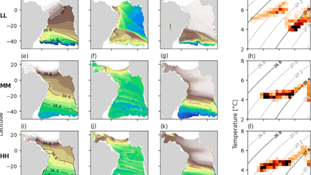
This study investigates the influence of model resolution on the representation of Antarctic Intermediate Water (AAIW) hydrographic properties and the role of eddies in the meridional transport of salt using three simulations from the HadGEM3-GC3.1 HighResMIP family with varying ocean resolutions: the 1° LL model (parameterized eddies), the 1/4° MM model (eddy-present), and the 1/12° HH model (eddy-rich). The control-1950 simulation is compared with the WOA18 climatology. Results show that increasing model resolution improves the representation of AAIW core properties (temperature, salinity, and density) and its northward extent. The LL model shows a restricted low-salinity tongue compared to observations, whereas the MM and HH models are more aligned with observations. Regions of high eddy kinetic energy coincide with major AAIW pathways in the MM and HH models, while the LL model is not able to capture the fine scale of the western boundary currents. The meridional salt transport is decomposed into its mean and eddy component and a compensation of both terms is found in MM and HH. The intermediate layer contributes to close to 30% of the total northward salt transport. Although total and eddy meridional salt transports are similar between MM and HH for the intermediate layer, the HH model contains more coherent eddies with greater westward propagation, suggesting distinct underlying mechanisms of salt transport. The findings highlight the limitations of the LL model in reproducing AAIW properties and circulation, with major improvements in the MM and HH models.