As our new Horizon Europe project EERIE (European Eddy-Rich ESMs) begins, we consider how it links to our previous Horizon 2020 project PRIMAVERA (Process-based Climate simulation: Advances in high resolution modelling and European climate risk assessment) and the associated High Resolution Model Intercomparison Project (HighResMIP, as part of CMIP6), and the way forward to better understand future risks of climate change on regional and local scales.
In order to be prepared for the multiple risks and impacts that weather and climate bring to our countries and communities now and in the future, we need an ecosystem of models and observations that allow us to understand the underlying processes and how these may change on global, regional and local scales. The regular Intergovernmental Panel on Climate Change (IPCC) reports describe the evolving understanding of our anthropogenic impact on climate and likely future consequences. Much of the modelling information in such reports comes from the Coupled Model Intercomparison Project (CMIP), to which climate modelling groups worldwide provide their latest simulation outputs, most recently to CMIP6. Such models incorporate atmosphere, ocean, land and sea-ice components, and many have increasingly complex biogeochemical components embedded within. The design of the core experiments in CMIP typically requires many thousands of years of model simulation, and so the total cost (including both the person-years in development and testing, and the computing, data processing and data storage) is very high.
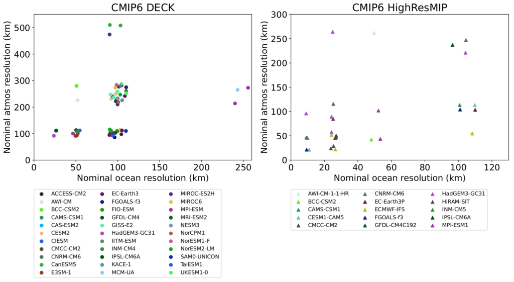
Fig. 1: CMIP6 model resolution.
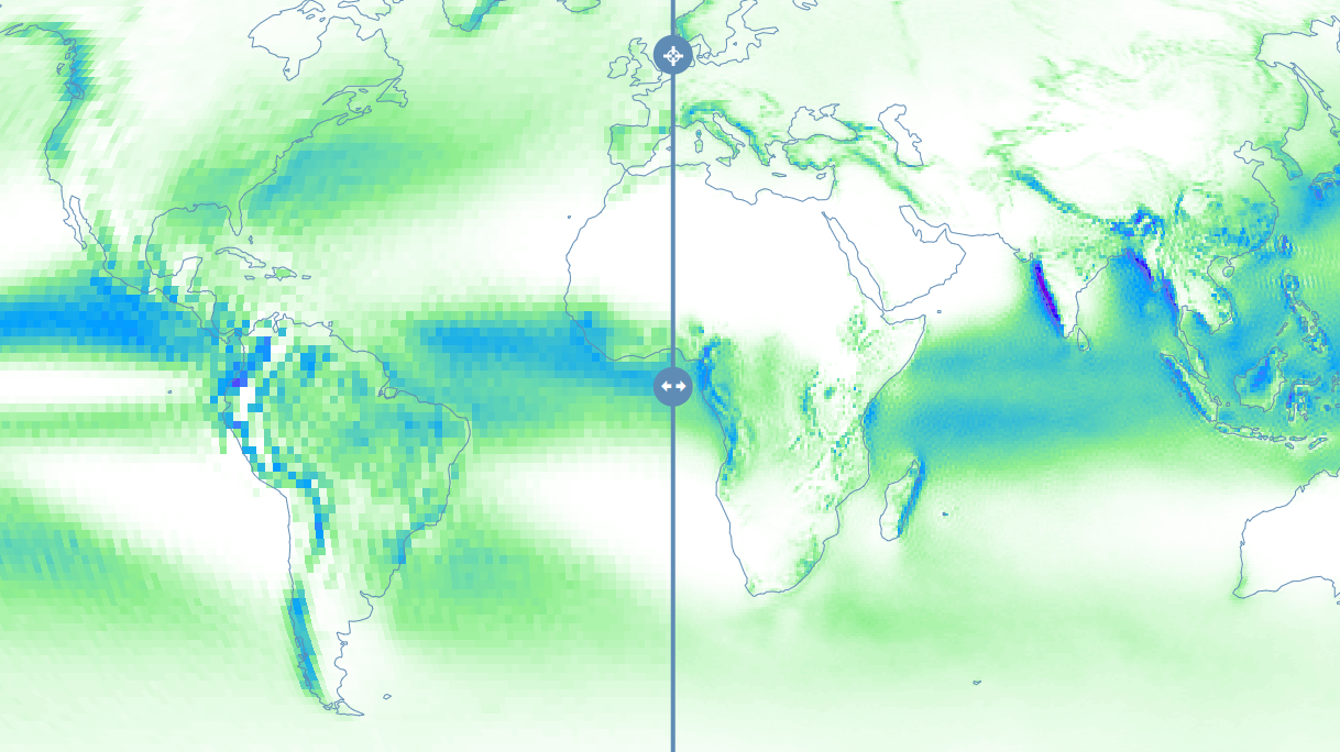
One consequence of this high cost is that the resolution of the climate models, that is the size of the grid boxes that divide up the globe for the simulation, have tended to remain around 100km in size in most models. This is likely adequate for looking at the global and largest-scales of climate (particularly the thermodynamical parts of the system), but is not enough to represent regional and local scales where dynamics (such as storm tracks) become crucial, and extreme processes that are governed by mesoscale phenomena such as tropical cyclones and ocean boundary currents (such as the Gulf Stream) and ocean eddies which are not represented in CMIP-class models.
It is process-enabling techniques, such as increasing resolution, that PRIMAVERA and HighResMIP aimed to address. HighResMIP was a new official MIP for CMIP6 aiming to produce multi-model simulations and insight into global climate at resolutions towards 25km in the atmosphere and ocean using a common experimental framework, to which around 16 international groups contributed simulations. The choice of 25km was a compromise - it allowed more groups to participate to enable a larger multi-model ensemble (and hence produce more robust results), and it allowed some groups to run ensembles of simulations (even if those were generally restricted to three or so members) to look at internal climate variability in models at these resolutions. PRIMAVERA both produced simulations for HighResMIP (from seven European modelling groups), and analysed the simulations to understand the implications of improved process representation and the consequence model fidelity on the simulated climate, climate variability and change, including extremes, with a focus on Europe.
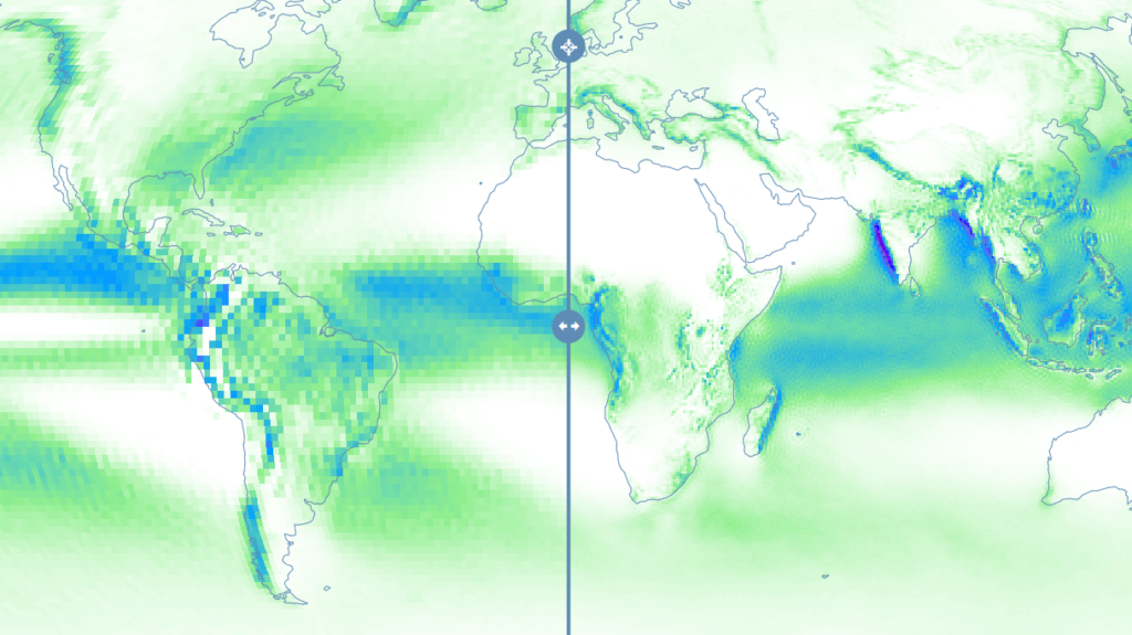
Fig. 2: Dynamic Map, PRIMAVERA User Interface Platform.
PRIMAVERA ran from 2015-2020 and comprised 19 institutes from across Europe. With well over 150 peer-reviewed papers and more than 150 references in the Intergovernmental Panel on Climate Change Sixth Assessment Report Working Group I (IPCC AR6 WGI) (also via HighResMIP work), the project had great scientific success. It also innovated by working with users of climate data (insurance sector, transport, renewable energy, energy grid network) to produce actionable information for their businesses. This also led to producing several derived datasets useful for impacts studies from the simulations (e.g. wind storm catalogue, tropical cyclone tracks database, storm surge and synthetic ensemble tropical cyclones).
One of the key improvements found in the PRIMAVERA coupled simulations at ~25km resolution was in the ocean circulation in the Atlantic. Long-standing mean biases, both in the tropics and at mid-latitudes, were greatly reduced. As a consequence, aspects of the atmospheric circulation, such as the storm track and blocking over Europe (which can lead to extreme weather in both summer and winter), were shown to improve. However there was still a significant spread in the biases across the models, suggesting that model resolution alone may not be sufficient, and perhaps improvements in model physics (such as parameterisation schemes, which were unchanged from the lower resolution models) may also be required.
The latter stages of PRIMAVERA produced two important papers (Grist et al. 2021; Moreno-Chamarro et al. 2021). Looking at future projections to 2050, we found that the highest resolution model in the ensemble (HadGEM3-GC31-HH, 25km in the atmosphere and 8km in the ocean) suggests considerably more rainfall in future winters over Northern Europe than the other models do. Our analysis suggests that this is due to an improvement in the simulation of the Gulf Stream in the present day – in all the other models, this current hugs the US coast for too long before moving out in the Atlantic, whereas at this resolution it separates earlier. In the future projection, the Gulf Stream is hence able to move northwards in this region, causing strong surface warming and interactions with the storm track.
Fig. 3: Linking the Gulf Stream warming, strengthened extratropical cyclones, and increased winter precipitation over North-Western Europe. Source: Can we trust CMIP5/6 future projections of European winter precipitation?
In addition to boundary currents, the ocean mesoscale plays a key role in the Southern Ocean, a region where IPCC AR6 points out that major uncertainties in future trends remain, due to insufficient process fidelity in current models, which could have significant implications for ice shelf melting and hence future sea level rise. There is also uncertainty about ocean upwelling regions which are nutrient rich and provide a large proportion of productive fishing areas. Such results suggest producing multi-model global coupled simulations with an ocean resolution of 10km or finer, as well as exploring other techniques, such as Stochastic Physics and Machine Learning, may provide better estimates of future uncertainty and climate risk assessments.
Such thinking and results led us to propose the EERIE project, with the goal of understanding the role of the ocean mesoscale in climate and climate change. As with PRIMAVERA, EERIE is focussed on centennial-multi-centennial climate simulation (to enable us to sample climate variability and extremes), and will aim to use models with grid spacings of 10km or less in the atmosphere, land, ocean and sea-ice. It therefore sits between projects such as nextGEMS in which the model resolution aims towards km-scales and timescales towards multi-decadal, and “standard” climate simulation at 100km scales. These models will allow us to better investigate process interactions (such as ocean boundary currents and eddies coupling with and changing the overlying atmosphere), as well as the risk of climate surprises (e.g. via processes not represented at lower resolutions). As well as modelling and analysis, EERIE will also work to improve the computational performance of models at these resolution, and provide improved workflows to produce useful climate information more efficiently. There will also be work using machine learning both by providing novel analysis methods, and speed up time-to-solution for these expensive models (hence reducing their carbon footprint), and improving links with simpler models.
One area of research from PRIMAVERA that will be extended in EERIE is to better understand the large-scale ocean circulation associated with the Atlantic Meridional Overturning Circulation (AMOC). This circulation in the Atlantic draws warm water polewards near the surface, where it cools and sinks at higher latitudes, and becomes part of the deeper ocean circulation, and plays a key role in the climate of the Atlantic and Europe. It is expected to weaken in future due to global warming, but there are uncertainties in the magnitude and speed of the changes, and also in the consequences of such changes on regional weather. With EERIE models we aim to better understand these uncertainties and what the important controlling factors are, and determine if any early warning signs of larger changes might be detected that could be useful for informing observational studies.
One of the painful lessons from PRIMAVERA was dealing the large volumes of data produced by the simulations (~1.5 PB), both in terms of the impact on model performance, and issues of data transfer, storage, accessibility and publication. With the even higher resolutions in EERIE, and greater interest in higher frequency ocean outputs, such issues need better treatment. We will consider several ways of reduce the data volumes, including compressing the output data (perhaps via machine learning methods), reduce transfer requirements and automate workflows to produce derived diagnostics locally (e.g. storm tracks) before sharing within the project and with the community.


